 © ArchaeoConcept
47e colloque international de l'Association Française pour l'Etude de l'Âge du Fer à Lausanne (Suisse) 2023
2023The 47th international colloquium of the Association Française pour l'Etude de l'Âge du Fer was held this year (2023) in Lausanne. The theme was War and its Procession. Cynthia Dunning Thierstein gave a lecture entitled "Le réseau des sites fortifiés du Premier Âge du fer entre le Plateau Suisse et le Jura: la sécurisation au service de l'économie?" co-authored with Jonas Glanzmann (History-Projects).
Summary
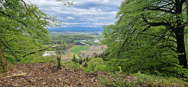
Recent discoveries of fortified sites dating from the First Iron Age, both in the Seeland and at the northern foot of the Jura mountains, raise the question of their function. Situated on eminences, they provided a means of keeping watch over vast territories. Their particular topographical situation means that they are all visible to one another, forming a network of strategic centres covering a large part of the Swiss Plateau. This network is strengthened by the distance between the fortified sites, which can easily be covered in a day's walk. The protective function of the fortified sites must inevitably be interpreted in the light of their topographical location. Some could be gathering places, others could be places where the territory was watched over. But the most striking feature is undoubtedly their location: they are all built at the crossroads of important routes. The sites were linked by routes that were regularly marked by the existence of burial mounds, grouped together in necropolises or isolated at strategic points. Their economic role, probably of supra-regional importance, cannot therefore be overlooked.
The fortified sites linked by clearly defined communication routes and the network of burial mounds, together with the open settlements, form a grid. Together, they define territories whose boundaries are generally drawn by topographical features such as rivers or steep valleys. It is worth noting that some places where people crossed between different territories yielded deposits of weapons or ornaments.
The discovery of new fortified sites, such as those on the Ins-Schaltenrain hill (canton of Bern) and at Rochefort (canton of Neuchâtel), was made possible by a large-scale survey. By combining the study of cartographic documents and field surveys, it was possible to trace the routes that linked these fortified sites.
Micro-topographic analysis of the intramural soil yielded some surprising results, which can be interpreted from comparative studies with sites excavated in other regions.
The results of this prospecting work have enabled us to broaden the perspectives conveyed by earlier studies, which generally focused on the distribution of burial sites and analysis of their contents, by refining our understanding of the structure of territories in the Early Iron Age.
The study of the relationships between different sites in the Seeland and the northern foothills of the Jura has led to the development of a territorial model based on topographical features, access routes and the distribution of territorial markers such as mounds and deposits. We have analysed a series of sites in neighbouring regions, such as the Swiss Plateau in Fribourg and Vaud, and the Swiss Plateau in Bern and Solothurn, in order to verify the proposed model. We could no doubt also propose adopting it for sites in the French Jura or Alsace.